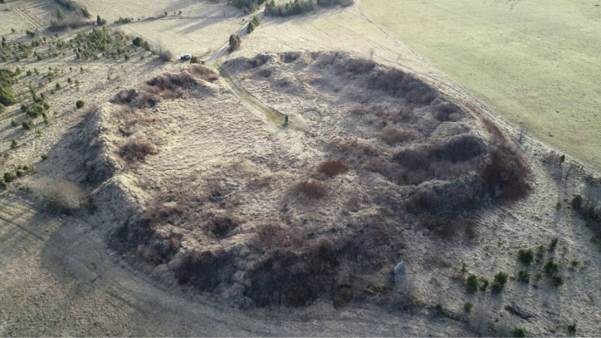
View of Muhu hillfort from the northeast (2019). Photo: Maili Roio.
Muhu hillfort is located in the southwestern part of Muhu Island, in the village of Linnuse, near the Väike Strait. The hillfort is best known for its association with the Livonian Crusade and the events of 1227, when it was reportedly plundered and burned down following a six-day siege.
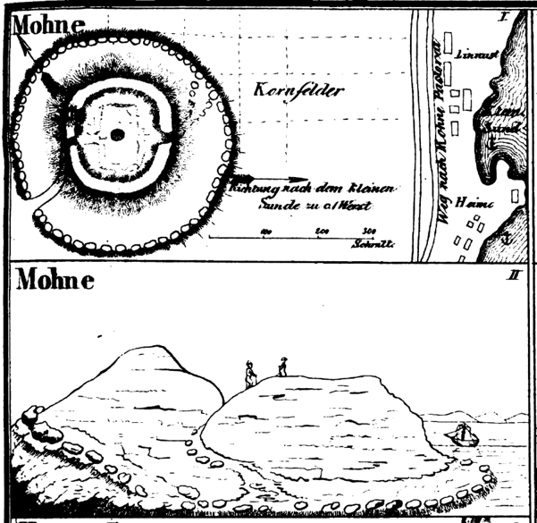
Drawing of Muhu hillfort by Friedrich Kruse, 1842.
The exact date of the hillfort’s construction is unknown, as it has never been archaeologically excavated. However, based on certain finds, it has been suggested that the hillfort may have been established as early as the 11th century. During the Late Iron Age and the Middle Ages, the shoreline was considerably closer to the hillfort than it is today, giving it a strategically advantageous position beside the Väike Strait.
Unlike many hillforts that benefited from naturally defensible terrain, Muhu hillfort was built on flat ground, and its defensive strength relied on a massive artificial ring rampart. The hillfort’s circular courtyard covers approximately 3,500 m², while the surviving sections of the rampart reach heights of 5-8 metres today. Friedrich Kruse’s drawing from 1842 indicates that, like the hillforts of Valjala and Kaarma, Muhu was also surrounded by an outer ring rampart. The gateways were located on the northern and southern sides.
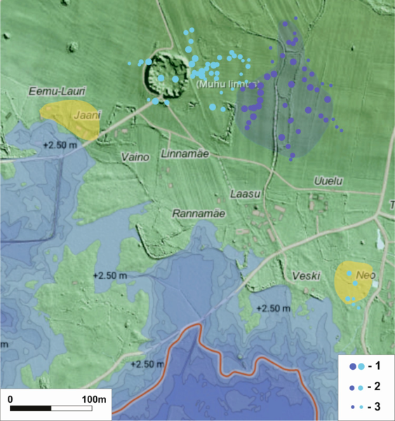
Test pits excavated around Muhu hillfort during archaeological investigations conducted by the Osiliana Foundation.
Archaeological investigations conducted by the Osiliana Foundation in 2025-2026, in cooperation with the metal-detecting clubs Detectelite and Osiliana Detektoristid, have provided new insights into Muhu hillfort and its surroundings. The investigations revealed that the hillfort formed part of an extensive Late Iron Age and medieval settlement complex, comprising the hillfort itself, a larger settlement that was probably a trading centre, and a possible harbour or landing site.
The most intensive cultural layer was discovered approximately 100-150 metres east of the hillfort. Through the excavation of nearly 100 test pits, an area of approximately 4.6 hectares was identified, where the darker soil contained numerous finds dating to the Late Iron Age and the Middle Ages. Cultural deposits were also identified in the immediate vicinity of the hillfort, with more scattered evidence to the south and northwest. A probable harbour or landing site was located approximately 340 metres southeast of the hillfort.
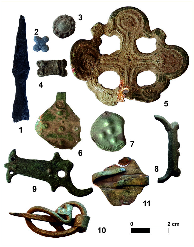
13th–14th-century finds from the urban settlement at Muhu. SM 10973: 397, 366, 185, 83, 203, 180, 172, 92, 86, 3, 210. Photos: Marika Mägi.
During these investigations, approximately 500 finds were recorded from the settlement site and the area surrounding the hillfort, about half of which were coins. Other finds included jewellery, dress accessories, bronze studs, iron objects, a crossbow bolt, fragments of a bronze cauldron, pottery sherds, and evidence of craft production and manufacturing waste. The finds date from the 10th to the 18th century, although the period of most intensive activity extended from the mid-12th to the late 14th century.
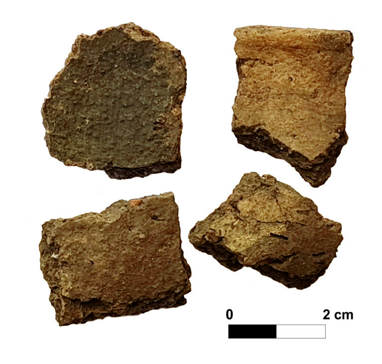
Pottery sherds discovered in a storage pit.
The excavations also uncovered remains of buildings, including the lower part of a wooden post and a stone-lined storage pit. Radiocarbon dates obtained from animal bones suggest that these features most likely date to the 12th century or the first half of the 13th century.
These discoveries offer a new interpretation of the description of Muhu in Henry of Livonia’s Chronicle. Henry uses two different Latin terms: castrum, meaning a fortress or hillfort, and urbs, meaning a “town”. Previously, these terms have been interpreted as different names for the same fortified site. However, the new archaeological investigations suggest that urbs may have referred to a larger settlement located beside the hillfort. Its size, substantial cultural deposits, and location along an important waterway suggest that it was more likely a trading centre than an ordinary agricultural village. Some of its inhabitants may have lived there only seasonally.
According to Henry’s account, the attack on Muhu appears to have begun somewhat unexpectedly. The chronicler writes that upon reaching the hillfort, the crusader army initially intended to rest there for just one night, but a confrontation broke out with the “men of the fortress” (HCL XXX, 4). Only after this encounter did the inhabitants of Muhu retreat behind their fortifications and send envoys during the night, expressing their willingness to accept Christianity and peace with the Christians. The offer of peace was rejected, and the siege of the hillfort began.
Henry’s account therefore does not suggest that the inhabitants of Muhu immediately sought refuge in the hillfort upon seeing the approaching army. Rather, they appear to have retreated only after the initial confrontation, suggesting that the first encounter may have taken place outside the fortifications, probably in the surrounding urbs. This interpretation is supported by the chronicle’s description of the final stages of the conquest, in which the capture of the castrum, or hillfort, is followed by a separate account of the plundering of the urbs, or “town”. In light of the new archaeological investigations, the “town” mentioned in the chronicle may be identified with the large settlement discovered east of the hillfort.
The siege lasted six days. The attackers employed stone-throwing siege engines and a siege tower and began undermining the rampart. The defenders also possessed stone-throwing engines and crossbows. On 3 February, the attackers managed to use an iron hook to tear down part of the wooden defensive structure on the rampart surrounding the hillfort. They then had to capture the central stronghold, which, according to Henry, was built of stone and frozen. The inhabitants of Muhu repelled the initial assaults, but the besiegers eventually broke into the hillfort, which was subsequently plundered and burned.
Henry then also describes the devastation of the “town”: property, horses, and livestock were taken away, while everything else was burned. If urbs referred to the settlement identified through archaeological investigations, the chronicle thus describes the destruction of both the hillfort and the adjacent trading centre as separate events. However, the 2025 investigations did not reveal evidence of widespread burning at the settlement site. Even if some buildings were destroyed in 1227, the settlement was probably rebuilt relatively quickly, as intensive activity continued there until at least the 14th century.
Following the conquest of Muhu, the crusader army advanced towards Valjala hillfort, where the local inhabitants reportedly decided to offer peace. The conquest of Muhu thus became one of the most notable events of the 1227 campaign against Saaremaa. In fact, few medieval castle sieges have been documented in as much detail as the siege of Muhu.
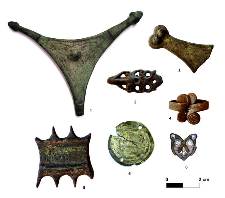
Late Iron Age finds discovered at the site of Muhu’s town. AM A 880:1, SM 10973: 7, 153, 210, 1, 18, 211. Photos: Ulla Kadakas, Marika Mägi.
The present-day appearance of Muhu hillfort differs considerably from that of the 13th century. Much of its ring rampart was removed in 1894-1895 to provide construction material for the Väike Strait causeway. During the removal of the rampart, two hoards were also discovered, containing silver and bronze jewellery, silver coins worn as pendants, glass beads, and weighing scales.
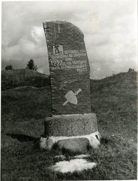
Memorial scuplture in the courtyard of Muhu hillfort. SM F 3201:24 F.
In 1928, a memorial was erected in the courtyard of the hillfort to commemorate those who fell in 1227. The memorial bore the inscription: “Honour to our brave ancestors who fell here in 1227 fighting against the German invaders and plunderers.”